Table of Contents
Federal Emergency Management Agency
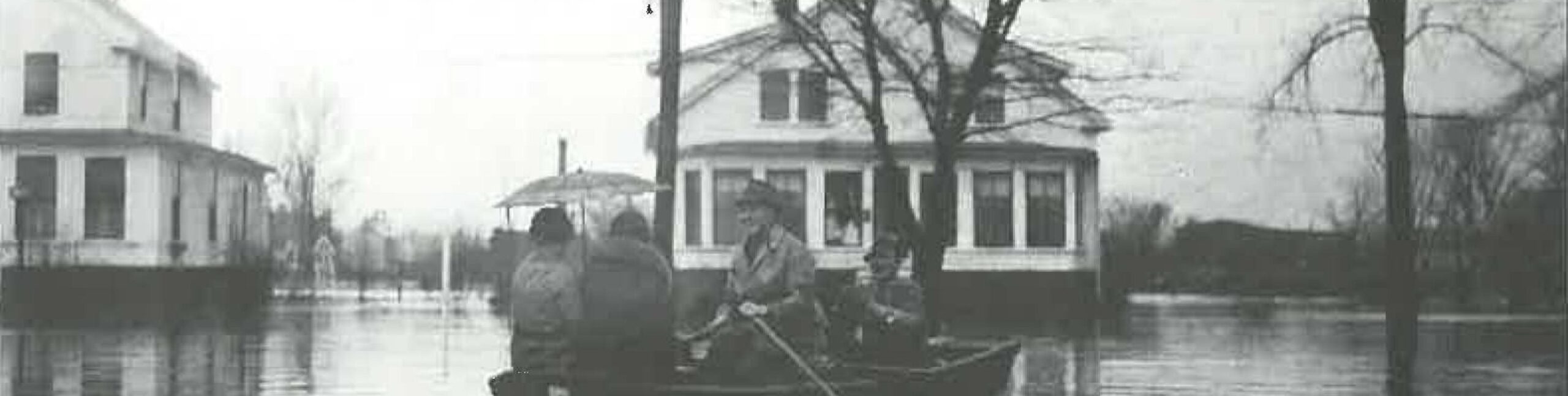
Did you know that flooding is the most common and costly natural disaster that happens in the State of New Hampshire? This portion of our website contains important information for residents about flooding in the City of Keene and recommended ways to reduce flood risk. If at any time you have questions or concerns, please give us a call or stop by between Monday – Friday, 8:00am – 4:30pm
Community Development Department
4th floor, City Hall
3 Washington St.
Keene, NH 03431
Michael Hagan, Certified Floodplain Manager/Community Rating System Coordinator
603.352.5440
Knowing Your Risks
Flooding can happen anywhere it rains but some areas have a higher risk from flooding than others. The City of Keene participates in the National Flood Insurance Protection (NFIP) which maps flood risks in our community. Using either FEMA’s Map Service Center or UNH’s GranitView map viewer, you can type in your address to find flood zones in your area. Follow these instructions if using GranitView.
Step 1. Type in the address in the search box in the upper right corner, including city and state
Step 2. Click on the ArcgGIS Geocoder option on the left, then the address. The map will narrow in to the selected address
Step 3. In the tool bar click on the View Layers option
Step 4. A list of filter options will populate on the left. From here, expand and click on the Inland Water Resources option; a list of map layers will appear. From here choose what you would like to see. You will want to click on Floodplains, Base Flood Elevations, Flood Hazard Lines and Areas.
If your property is located in the flood zones, then special requirements may apply if you are planning to make changes on your property. For more details on these changes, see the Build Responsible section below.
For more information on definitions, descriptions and guidance on the flood zones, follow this link to the FEMA website.
Insuring Your Property
No home is completely safe from potential flooding. Unfortunately, most homeowner’s insurance policies do not cover floods. Flood insurance can be the difference between recovering and being financially devastated: just one inch of water in a home can cause more than $25,000 in damage. You do not have to be in a higher risk flood zone to buy flood insurance. In fact, almost 25% of flood insurance claims are outside of higher risk flood zones. Find out more about buying flood insurance, Preferred Risk Policy for properties in a low to moderate flood risk.
If you are considering buying flood insurance, remember that:
- Contents and building coverage for flood insurance are purchased separately. Know what is covered under each-usually it’s a good idea to have both
- In most cases flood insurance policies have a 30-day waiting period from the date of purchase before the policy goes into effect although there are exceptions
- This information can be confusing and overwhelming which can lead to misinformation. One such item is that FEMA will only pay residents if the city is declared a state of emergency and that no insurance is needed. This is a FALSE statement. The National Flood Insurance Policy (NFIP) pays out for all flooding damage to its policy holders regardless of a declared state or not
- Another misconception is that during a declared state of emergency, FEMA will pay for any damages due to a flood. This too is a FALSE statement. FEMA only offers low interest loans to repair damages to a community experiencing an emergency. It is ONLY the insurance policy holders who receive money without having to have it loaned to them. With no NFIP insurance, you have no coverage, no matter where you live
- To determine the cost of your flood insurance, the base elevation needs to be determined for your home or property and compared to the base flood elevation for your property. To determine this, a flood elevation certificate must be prepared by a licensed surveyor, engineer or architect. You can contact the Community Development Department for recommendations, (603) 352-5440 or consult your local yellow pages
Once you obtain an elevation certificate, you can call your insurance agent to request a rate quote for flood insurance. You can view the issued elevation certificates here (need to change to in bedded pdf of listed EC’s).
Learn more about flood insurance at Flood Smart’s website or contact your insurance agent today.
Protecting Yourself, Your Family & Your Community
These simple steps listed below are things you can do right now to keep you, your family and your community safe during a future flood.
- Sign up to get text, email or phone emergency alerts for your area through the NH Department of Safety NH Alerts system at Ready NH’s website.
- Bookmark the National Weather Service’s Grey-Portland, ME webpage for the latest flood forecast information
- You can also get real-time flood height predictions for rivers and other water bodies that have flood gauges. The gauge along the Swift River in Roxbury affects our community. You can access information for this gauge online.
- Sit down with your family and decide what you’ll do when a flood or other emergency happens. Visit Ready NH’s website to learn more about creating an emergency plan, what to have on hand in an emergency kit and by creating an emergency contacts card for everyone in your family
- Lastly, visit the American Red Cross website who also has vital information about floods, what to do right before a flood hits, during a flood and what to do after.
Remember this simple message of When Flooded Turn Around, Don’t Drown!
Protecting Your Property
There are relatively simple, low-cost steps you can take as a homeowner to protect your home from flooding.
- Improve the grading around buildings
- Elevate utilities and service equipment
- Install sewer backflow valves for pipes entering the building
Download this brochure from FEMA to gain more low cost ideas to protect your property and other steps you can take in Protect Your Home and Property from Flood Damage.
Elevating a building above the flood elevation for the area is one of the best ways to protect your property from flooding. If elevated, your building will have much less damage from future floods and the cost of flood insurance will also be much lower. Learn more by downloading and reviewing these FEMA brochures The Costs and Benefits of Building Higher brochure and FEMA’s Protecting Your Home and Property from Flood Damage.
Elevation Certificates are forms that contain elevation information for a specific building. These completed forms are used for different purposes including:
- To verify compliance with the City of Keene’s floodplain management ordinance
- To determine flood insurance rates
- As part of an application for a Letter of Map Amendment (LOMA)
The City of Keene has Elevation Certificates on file for the following property addresses. For further information on these or to obtain a copy of an elevation certificate, contact the Community Development Department.
Building Responsibly
The City of Keene has adopted a Floodplain Management Ordinance found in Article 23 of the Land Development Code that helps protect lives and property in our community from future floods. To comply with this ordinance you will need to obtain a floodplain development permit from the City of Keene before you perform development activities in a higher risk flood zone including, but not limited to:
- New construction of buildings or placement of a manufactured home
- Substantial improvements/renovations to existing buildings or manufactured homes
- Placement of fill
- Excavation, grading, paving or dredging
- Storage of equipment and/or materials
- Relocating a water course
- New or updated septic systems
- Placement of docks, piers, boat ramps
Once you receive your permits, you will need to comply with building requirements in the City of Keene ordinance. For example, if applicable, development will need to:
- Be reasonably safe from flooding
- Be designed and constructed with methods and practices that minimize flood damage
- Be designed and adequately anchored to prevent flotation, collapse or lateral movement
- Be constructed with flood damage-resistant materials
- Be constructed with electrical/utility systems designed or located to prevent flood damage to components.
New construction and “Substantially Improved” or “Substantially Damaged” residential buildings will also need to have the lowest floor of the building elevated to or above the flood elevation that applies.
Contact the Community Development Department to learn more, including how to obtain a permit.
Protecting The Natural Floodplains
We can all do our part to protect the natural flood plain functions of our community, specifically the Ashuelot River and Beaver Brook. We are all an important part of helping to manage those systems.
A watershed is the area of land that water flows across or seeps into on its way to a river, lake or stream. Watersheds are separated from each other by high points such as the crest of a hill.
Everyone lives in a watershed and should be able to enjoy healthy streams and the opportunities they provide. Almost every human activity, from lawn care to recreation, affects the quantity and quality of water in the watershed. We share our watershed with wildlife that also depends on a healthy watershed for food, shelter and water.
The health of a watershed and its inhabitants depends on clean water. Preventing pollution in streams and brooks avoids costly impacts to our health, our community and our economy.
Smart storm water management is vital to protecting our watershed and reducing the chances of flooding.
Parking lots, driveways, streets and rooftops prevent rain and snow from falling directly on the ground and infiltrating, or soaking in the soil. Rainfall on these surfaces becomes storm water runoff. As it flows through ditches, culverts and street drains, storm water accumulates pollutants such as fertilizer, yard waste and animal waste, oil, road salts, chemicals, solid particles and litter and flows untreated into waterways.
Too much runoff quickly draining into the brooks can cause local flooding where storm water that is allowed to soak into the ground enters streams more slowly.
You are an important part of helping to manage those streams and brooks. You can control runoff in the following ways:
- Drain sump pumps into lawns instead of back into the sewer or road ditch
- Replace driveways and walkways when needed to help smooth surfaces that help water flow directly into sewers
- Disconnect downspouts from the sewer system. Downspouts should drain into vegetated areas to reduce sewer overflows, steam flooding and basement flooding
- Use a grass catcher when mowing the lawn to minimize the grass clippings that run into the sewer system
- Manage pet waste. Don’t allow it to be left on paved surfaces where it can wash into streams, brooks or storm drains
- Never put anything in the sewer lines. And please don’t pour grease down your drains.
Lastly, we all need to be good caretakers of our brooks and streams. Undisturbed land along the banks with native trees and shrubs that have roots help to stabilize the soil to prevent it from being washed away. Don’t ever disturb the bank by placing fill or removing gravel or vegetation. And, never dump garbage into the brook or any stream.
Together, with everyone doing their part, we can preserve the natural floodplain functions in our community.
For construction to be done in the flood plain/zone
FEMA Elevation Certificate Instructions
Flood Proofing Certificate Application
Important Links
The City of Keene has adopted a Floodplain Management Ordinance found in Article 23 of the Land Development Code that helps protect lives and property in our community from future floods.